Sun, Steam, and Afternoon Storm Risks: Tuesday on the Coast

Overview of the Day
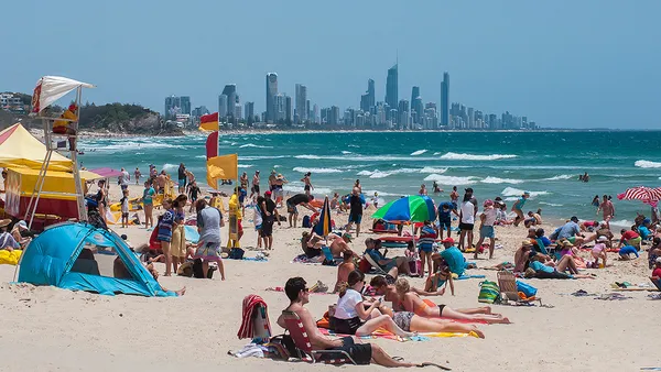
Welcome back to goldcoast.news. As we head into Tuesday, February 10, 2026, Gold Coast residents and visitors should prepare for a classic summer day characterized by high temperatures and the building potential for late-day atmospheric activity. The morning promises plenty of sunshine, but as the heat peaks, a shift in conditions is expected to bring a change to the coastal skyline.
Temperature and Humidity
It is set to be a warm day across the region. Temperatures are expected to start at a mild overnight minimum of 23°C, rising steadily throughout the morning. By the early afternoon, the mercury is predicted to reach a maximum of 31°C. Due to the high humidity levels typical of February, the 'feels like' temperature may sit several degrees higher, particularly in areas away from the immediate cooling influence of the ocean breezes.
Morning and Midday Forecast
The first half of the day will be dominated by mostly sunny skies, making it an ideal time for outdoor activities or a visit to the beach. However, this is also when the sun will be at its most intense. The Bureau of Meteorology has issued a warning regarding an 'Extreme' UV Index, which is expected to reach level 12. Sun protection is strongly recommended between 7:50 am and 4:00 pm. Residents are urged to seek shade and use appropriate skin protection during these peak hours.
Afternoon Showers and Hinterland Storms
As we move into the afternoon and evening, sky conditions will turn partly cloudy. There is a medium chance—currently rated at 40%—of showers affecting the Gold Coast area. While total rainfall is expected to be minimal, likely under 1mm for most coastal suburbs, the Hinterland faces a more significant weather threat. There is a predicted risk of thunderstorms developing over the ranges in the late afternoon and evening, which could bring localized heavy bursts of rain and lightning to those areas.
Wind and Safety Notices
Winds will begin the day as light and variable. By the late afternoon, a northeasterly surge of 15 to 20 km/h is expected to develop along the coastline before dying down again in the evening. The Fire Danger Rating for the region remains at 'Moderate.' Residents are advised to stay hydrated and keep a close eye on the western horizon for any rapidly developing storm cells during the evening commute.

Van Morrison Tributes and Midnight Dancing: What’s On in the Gold Coast Today
Burleigh Surfs Toward Sunshine: Your Tuesday Morning Briefing
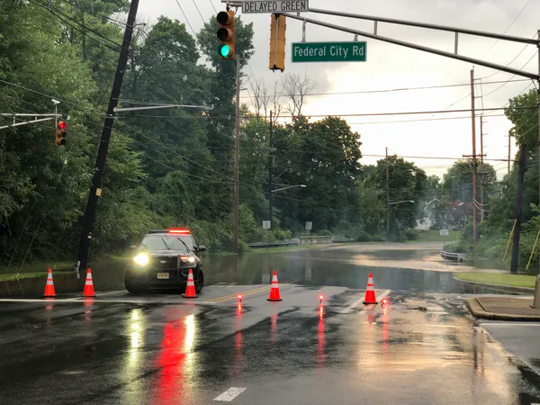
Commuters Advised of Single-Lane Restrictions and Residual Flood Closures This Tuesday